New Mobile Site
We have just launched a new mobile version of this site - m.trainspots. This page will use your smart device's GPS to loctate you and guide you to locations that are close to your present location.
Location notes
North of Doncaster this location is a pair of level crossings, one of them over the Doncaster to Leeds line and the other over the East Coast Main Line between Doncaster and York.
Railway type and traffic
Usual mid East Coast Main Line traffic:
NXEC: 91s, HSTs, 180s
Local: Various sprinter derivatives
DB Schenker: 60 and 66s on Intermodal, Engineers and Coal
Freightliner: 66/5 on Liners and Heavy Haul 66/5 on Coal Traffic.
NXEC: 91s, HSTs, 180s
Local: Various sprinter derivatives
DB Schenker: 60 and 66s on Intermodal, Engineers and Coal
Freightliner: 66/5 on Liners and Heavy Haul 66/5 on Coal Traffic.
Environment
Two level crossings on a small road to the north of Doncaster. One on side of the crossings is a housing estate and on the other is an industrial estate.
Road directions
From the A1(M), Junction 37:
Follow the A635 towards Doncaster and Scawsby. Continuing to the right at the traffic lights when you join the A638 York Road. Keep to the left and at the traffic lights follow the road onto the A19 towards Selby, signed Askern and Bentley. At the next set of traffic lights follow the right turn signs towards Bentley Ings Industrial estate. Towards the end of this road turn left and you will reach the location.
Click here to set up your location for directions to this location
Ings Road Crossings, Doncaster map co-ordinates
Parking
There is parking in the surrounding streets.
Public transport
It is an approximate 10-15 min walk from Doncaster Station.
Click here to set up your location for directions to this location
Click here to set up your location for directions to this location
Amenities
Doncaster and the Frenchgate Shopping Centre has all you should need.
Accommodation
Nothing in the immediate vicinity, but Doncaster has plenty of hotels and travel inns.
Sun Compass
Sun Compass using Suncalc by brought to you by Vladimir Agafonkin:
It might be necessary to adjust the time to suit your visit, this link should open with the current day.
Ings Road Crossings, Doncaster
Streetmap links
Ings Road Crossings, Doncaster general view map
Ings Road Crossings, Doncaster close up map
Windows Local Live Link - image quality may vary
Ings Road Crossings, Doncaster
It might be necessary to adjust the time to suit your visit, this link should open with the current day.
Ings Road Crossings, Doncaster
Googly map
Ings Road Crossings, Doncaster general view map
Ings Road Crossings, Doncaster close up map
Windows Local Live Link - image quality may vary
Ings Road Crossings, Doncaster
Who likes this location on facebook
Railway Gen Group
Photographic notes
You can photograph from all locations around the two crossings, as well as a sideways view to the crossing opposite.
Videographers should note that the of a weekday there is a lorry traffic to and from the industrial estate which will add some noise to your videos.
Videographers should note that the of a weekday there is a lorry traffic to and from the industrial estate which will add some noise to your videos.
General views - All photographs © Tony Rispoli unless otherwise stated
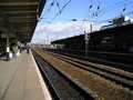
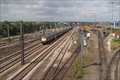
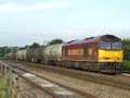
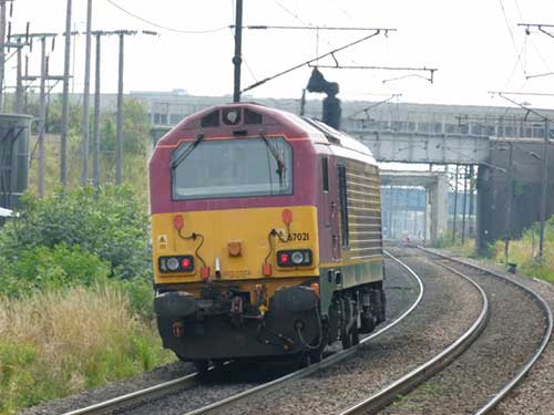
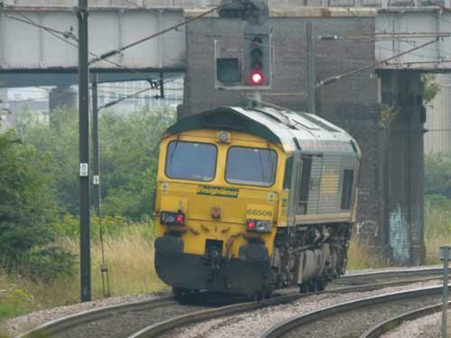
Fig 1 - Looking North
Main Line looking in the direction of York
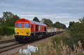
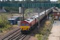
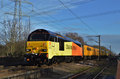
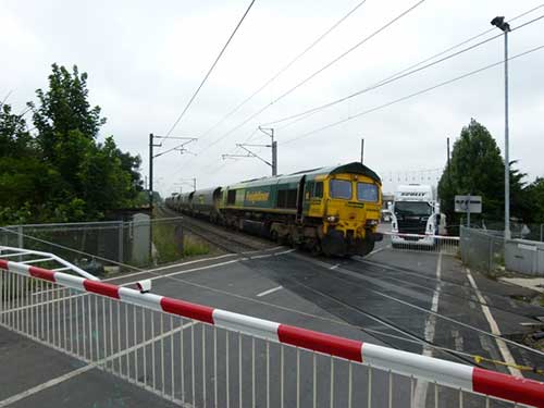
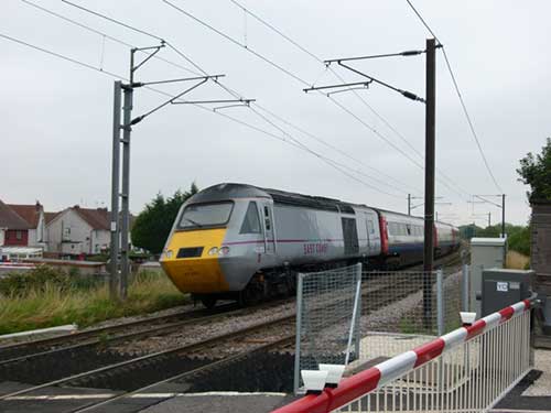
Fig 2 - Looking south
Main Line looking in the direction of Doncaster
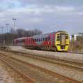
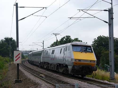
Fig 3 - Looking south
Main Line looking in the direction of Doncaster
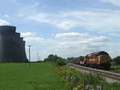
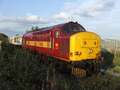
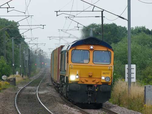
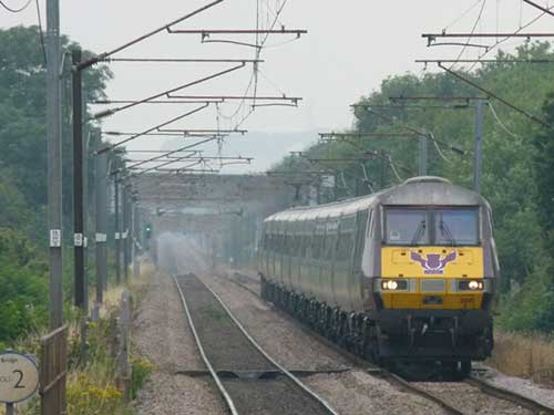
Fig 4 - Looking north
ECML looking towards York
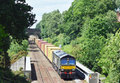
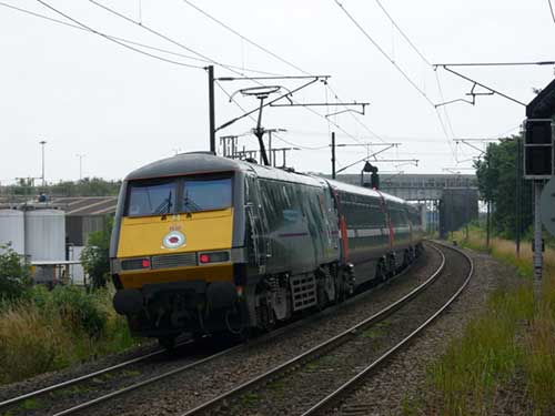
Fig 5 - Looking south
Leeds branch, looking towards Doncaster
Fig 6 - Looking north
Leeds branch, looking towards Leeds
Fig 7 - Looking south
Leeds branch, looking towards Doncaster
Fig 8 - Looking north
Leeds Branch, looking towards Leeds
Disclaimer
All information contained within this is site is © Trainspots. The images used on this site remain the property of the original photographer, as credited at the top of the page, and are used with their kind permission.
The information on these pages is supplied for the benefit of railway enthusiasts who carry out a harmless hobby, and through the medium of photography and video, actually promote the railway industry. Railway enthusiasts can also act as eyes and ears against railway vandalism, and as such should surely be encouraged to do so by the supply of adequate information such as is found on this website.
This site has been created to assist railway photographers in their travels around the country. It is based on the personal knowledge and experience. No liability can be held against the web site or its contributions for incorrect information. Trainspots will endeavour to check all information and corrections will be accepted and posted accordingly.
Advice as to the locations general environment is given as a guide on each page. This information is a GUIDE only. ALWAYS be careful with your equipment, Trainspots can not be held responsible for your personal security. Avoid leaving your property on display for all to see, be aware of your surroundings at all times. There are, sadly, people who will not think twice about trying to steal your equipment.
Trainspots DOES NOT condone trespass and none of the information on this site should be taken as a right to trespass on either railway or private land. To the best of our knowledge all locations are publicly accessible areas, where they are not contact information will be given to the appropriate authority for permission to be obtained.
The content of this site is created and intended for all age ranges but the content of sites linked from this site are not subject to the same intentions. Trainspots will attempt to check links for validity but as time passes and the site grows this will not always be possible. Broken, or indeed updates to, links should be submitted to the editor for inclusion in the updates. All links external to the Trainspots site are opened in a new browser window. Trainspots has been running now for over 10 years and there are imitation sites and guides to railfotspots. But we are a free site and we continue on the path we started out on over a decade ago to provide a useful guide to UK Railway Photographic Locations.