New Mobile Site
We have just launched a new mobile version of this site - m.trainspots. This page will use your smart device's GPS to loctate you and guide you to locations that are close to your present location.
Location notes
Browney is located about 4 miles south of Durham on the East Coast Main Line.
Railway type and traffic
Passenger:
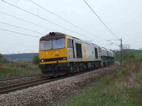
Hourly TPE 185s, East Coast HSTs and 91 MkIVs, Virgin Voyagers. Northern Rail 142, 156, 158 note that only limited to morning rush hour period, and a late evening service. Can be also seen running ECS to/from Heaton/Newcastle and Darlington/York.
Freight:
DB Schenker: 60 or 66, sometimes 92 on some night services.
Coal (HTA & MGR), Steel/ Aluminium, Auto, Oil, Enterprise, Limestone, Scrap.
GBRf: 66
Coal, Mud Oil (ran when required)
FLHH: 66
Coal
DRS: 20, 37, 47, 66
Kingmoor- Haverton Hill and rtn flats to/ off repair, light engine.
NR/ Serco Test Trains:
67s, Serco, NMT HST, DMUs, FMUs.
Engineers/ Track Machines various operators. These run as required.
Environment
An access lane to a water works.
Road directions
To access Browney you need to drive/ walk down a lane called River View off the B6300 between A167 at Croxdale and A690 Brandon, and parking is available next to the access gate onto the ECML.
Click here to set up your location for directions to this location
Browney map co-ordinates
Click here to set up your location for directions to this location
Browney map co-ordinates
Parking
Beware: When turning into the lane as it's width is for one vehicle only and Water Tankers and site traffic use this lane to access the water works.
Public transport
The nearest train station is Durham about 3-4 miles north.
Local buses run from Durham bus station towards Brancepeth and Crook. If in doubt ask at the travel centre in Durham Bus station about which bus will take you close to Browney Lane.
Click here to set up your location for directions to this location
Local buses run from Durham bus station towards Brancepeth and Crook. If in doubt ask at the travel centre in Durham Bus station about which bus will take you close to Browney Lane.
Click here to set up your location for directions to this location
Amenities
There are no facilities available at this rural location. There is no shelter, open to the elements, especially the wind as on top of a hill.
The nearest shops are in Browney/ Brandon about half a mile - 1 mile away.
The nearest shops are in Browney/ Brandon about half a mile - 1 mile away.
Sun Compass
Sun Compass using Suncalc by brought to you by Vladimir Agafonkin:
It might be necessary to adjust the time to suit your visit, this link should open with the current day.
Browney
Streetmap links
Browney general view map
Browney close up map
Windows Local Live Link - image quality may vary
Browney
It might be necessary to adjust the time to suit your visit, this link should open with the current day.
Browney
Googly map
Browney general view map
Browney close up map
Windows Local Live Link - image quality may vary
Browney
Who likes this location on facebook
Railway Gen Group
Photographic notes
The only view available is on the west side of the line.
Early sightings of trains are available from the south by looking across onto Croxdale Viaduct, and from the north is a good length of straight. Of note trains have a climb off Croxdale Viaduct round a bend towards Durham.
Early sightings of trains are available from the south by looking across onto Croxdale Viaduct, and from the north is a good length of straight. Of note trains have a climb off Croxdale Viaduct round a bend towards Durham.
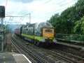
General views - All photographs © Jonathan Hare unless otherwise stated
Fig 1 - Looking north
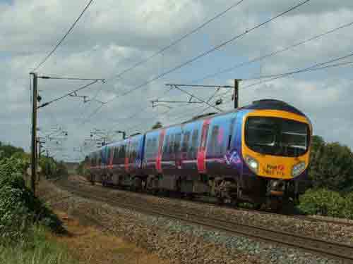
Fig 2 - Looking south
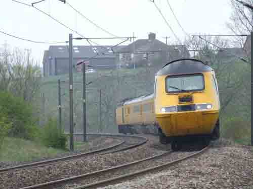
Fig 3 - Looking south
Disclaimer
All information contained within this is site is © Trainspots. The images used on this site remain the property of the original photographer, as credited at the top of the page, and are used with their kind permission.
The information on these pages is supplied for the benefit of railway enthusiasts who carry out a harmless hobby, and through the medium of photography and video, actually promote the railway industry. Railway enthusiasts can also act as eyes and ears against railway vandalism, and as such should surely be encouraged to do so by the supply of adequate information such as is found on this website.
This site has been created to assist railway photographers in their travels around the country. It is based on the personal knowledge and experience. No liability can be held against the web site or its contributions for incorrect information. Trainspots will endeavour to check all information and corrections will be accepted and posted accordingly.
Advice as to the locations general environment is given as a guide on each page. This information is a GUIDE only. ALWAYS be careful with your equipment, Trainspots can not be held responsible for your personal security. Avoid leaving your property on display for all to see, be aware of your surroundings at all times. There are, sadly, people who will not think twice about trying to steal your equipment.
Trainspots DOES NOT condone trespass and none of the information on this site should be taken as a right to trespass on either railway or private land. To the best of our knowledge all locations are publicly accessible areas, where they are not contact information will be given to the appropriate authority for permission to be obtained.
The content of this site is created and intended for all age ranges but the content of sites linked from this site are not subject to the same intentions. Trainspots will attempt to check links for validity but as time passes and the site grows this will not always be possible. Broken, or indeed updates to, links should be submitted to the editor for inclusion in the updates. All links external to the Trainspots site are opened in a new browser window. Trainspots has been running now for over 10 years and there are imitation sites and guides to railfotspots. But we are a free site and we continue on the path we started out on over a decade ago to provide a useful guide to UK Railway Photographic Locations.