New Mobile Site
We have just launched a new mobile version of this site - m.trainspots. This page will use your smart device's GPS to loctate you and guide you to locations that are close to your present location.
Location notes
These footpath locations have been temporarily closed as of 2011 and will likely remain closed indefinitely.
Tallington village lies between Stamford and Market Deeping, just to the north west of Peterborough.
Tallington village lies between Stamford and Market Deeping, just to the north west of Peterborough.
Railway type and traffic
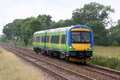
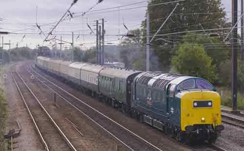
Regular East Coast and Hull trains pass the location, as do some freight workings.
Environment
These crossings are in the fields, which are usually home to sheep.
Road directions
From Stamford on the A1 head east on the A16 which is signposted to Spalding. This road takes you straight to Tallington. As you near the end of this village, look out for 'Mill Lane' on your right, and take this turn. You should notice a hall and a park on the left just a few yards down this lane, and ample space to park your motor. You should also see the footpath which is well signposted.
To get to the second crossing, continue down Mill Lane which will bend sharply to the left. It will then bend sharply to the right, and it is at this point where you will need to park on the wide grass verge. Follow the public footpath to the railway.
Click here to set up your location for directions to this location
Tallington Crossings map co-ordinates
Parking
Park on the wide grass verge then follow the public footpath to the railway.
Public transport
Amenities
Tallington offers a good pub, The Whistle Stop, which provides food,and of course liquid refreshments! Right opposite is a Londis store.
There is also a useful local shop in the village.
Sun Compass
Sun Compass using Suncalc by brought to you by Vladimir Agafonkin:
It might be necessary to adjust the time to suit your visit, this link should open with the current day.
Tallington Crossings
Streetmap links
Tallington Crossings general view map
Tallington Crossings close up map
Windows Local Live Link - image quality may vary
Tallington Crossings
It might be necessary to adjust the time to suit your visit, this link should open with the current day.
Tallington Crossings
Googly map
Tallington Crossings general view map
Tallington Crossings close up map
Windows Local Live Link - image quality may vary
Tallington Crossings
Who likes this location on facebook
Railway Gen Group
Photographic notes
These footpath locations have been temporarily closed as of 2011 and will likely remain closed indefinitely.
Shots can be taken from both sides of the line, and also in both directions, so a variety of shots can be had throughout the day, although some shots are obviously better than others as can be seen in the views below.
Shots can also be had from the footbridge near the main road crossing, but the bridge design favours south facing shots and the catenary masts can be troublesome here.
General views - All photographs © Jason Rodhouse unless otherwise stated
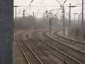
Fig 1 - Looking north west
Fig 2 - Looking north west
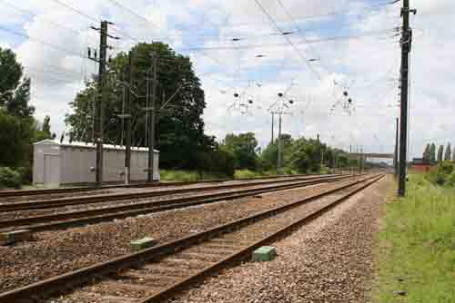
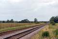
Fig 3 - Looking south east
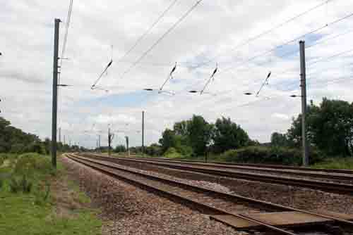
Fig 4 - Looking south east
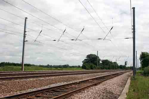
Fig 5 - Looking south east
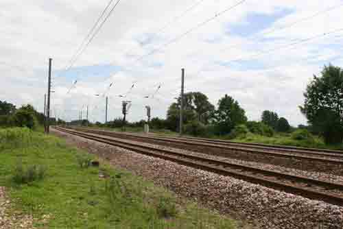
From further along the foot path to the south.
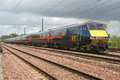
Fig 6 - Looking north west
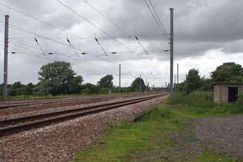
From the 2nd foot crossing.
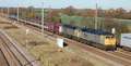
Fig 7 - Looking north west
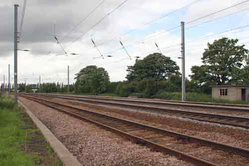
From the 2nd foot crossing.
Fig 8 - Looking south east - photo © Albert Dawson
From the foot bridge
Disclaimer
All information contained within this is site is © Trainspots. The images used on this site remain the property of the original photographer, as credited at the top of the page, and are used with their kind permission.
The information on these pages is supplied for the benefit of railway enthusiasts who carry out a harmless hobby, and through the medium of photography and video, actually promote the railway industry. Railway enthusiasts can also act as eyes and ears against railway vandalism, and as such should surely be encouraged to do so by the supply of adequate information such as is found on this website.
This site has been created to assist railway photographers in their travels around the country. It is based on the personal knowledge and experience. No liability can be held against the web site or its contributions for incorrect information. Trainspots will endeavour to check all information and corrections will be accepted and posted accordingly.
Advice as to the locations general environment is given as a guide on each page. This information is a GUIDE only. ALWAYS be careful with your equipment, Trainspots can not be held responsible for your personal security. Avoid leaving your property on display for all to see, be aware of your surroundings at all times. There are, sadly, people who will not think twice about trying to steal your equipment.
Trainspots DOES NOT condone trespass and none of the information on this site should be taken as a right to trespass on either railway or private land. To the best of our knowledge all locations are publicly accessible areas, where they are not contact information will be given to the appropriate authority for permission to be obtained.
The content of this site is created and intended for all age ranges but the content of sites linked from this site are not subject to the same intentions. Trainspots will attempt to check links for validity but as time passes and the site grows this will not always be possible. Broken, or indeed updates to, links should be submitted to the editor for inclusion in the updates. All links external to the Trainspots site are opened in a new browser window. Trainspots has been running now for over 10 years and there are imitation sites and guides to railfotspots. But we are a free site and we continue on the path we started out on over a decade ago to provide a useful guide to UK Railway Photographic Locations.