New Mobile Site
We have just launched a new mobile version of this site - m.trainspots. This page will use your smart device's GPS to loctate you and guide you to locations that are close to your present location.
Location notes
Single track branch that comes off the Birmingham to Bristol Branch at Yate, loops under the main Great Western mainline and runs into the Murco Oil Storage Terminal at Westerleigh.
Railway type and traffic
This is a freight only line that at present (Jan 2010) sees two heavy tank trains per day. One inbound, one outbound. They usually are reliable but can run early, late or cancel at short notice! Patience and a wait is often required!! Generally on a Saturday the outbound train leaves about 10:00-10:15 and the inbound is at the railhead by 12:20.
Power is provided by double head 66s or eratically by dwindling class 60s.
Anybody with a good camera can shoot trains coming over the top of the branch if they are down at the village foot crossing whilst they are waiting. The viaduct carrying the Great Western Mainline is just in front of you and a good zoom will capture HSTs, Sprinters, Freightliner and DBS 66s passing.
Environment
Open countryside, with the odd lorry passing by.
Be careful of the lorrys on the main road by the railhead, they are traveling at speed.
The path to ram hill is also a cycle and bridleway; it gets muddy and churns up badly in places. Do not wear your best trainers!!
Be careful of the lorrys on the main road by the railhead, they are traveling at speed.
The path to ram hill is also a cycle and bridleway; it gets muddy and churns up badly in places. Do not wear your best trainers!!
Road directions
Two places to go. Come out of Westerligh Village on the B4465 at the traffic lights and turn right. Up the road there is a left turn marked up as the Murco Railhead and to an abattoir. Its a lane that forks into a left side road. The entrance is marked as 'private road, visitors only'. Thats the road down to the rail head. Initially I parked and walked using a public footpath using an OS map. However several photographers were already down there parked up; also a public footpath cuts right across the road and over a public level crossing. So long as you do not photograph the depot infrastructure further down the road there should be no problem at all.
Back in the Village theres a very good vantage point at a public crossing that crosses the line. Drive into the village centre, past the pub and war memorial. As you come out of the village theres some Car repair places on the right and a DIY/come ironmongery type store with a sign resembling a pub. Opposite is a blue sign showing a man on foot/bike symbol stating 'Coalpit Heath' Cycle/Railway path. Follow that down the track and the crossing is a 1 minute walk.
The Railhead is on the B4465 just outside the village
The public path is off the main road through the village
Click here to set up your location for directions to this location
Westerleigh map co-ordinates
Click here to set up your location for directions to this location
Westerleigh map co-ordinates
Parking
You can drive easily almost up to the railhead but security is tight in the area.
Road is wide but be aware of road tankers constantly coming up and down the road.
Either park in Westerleigh (the path starts there over the road from a DIY shop called 'Nic Nacs'; or the other end is the hamlet at Ram Hill. Both are very safe.
Road is wide but be aware of road tankers constantly coming up and down the road.
Either park in Westerleigh (the path starts there over the road from a DIY shop called 'Nic Nacs'; or the other end is the hamlet at Ram Hill. Both are very safe.
Public transport
Westerleigh is served by buses to Yate
Click here to set up your location for directions to this location
Click here to set up your location for directions to this location
Amenities
Westerleigh is very sparse; there are a few pubs but almost no shops. Nearest town is Yate about 4 miles away.
Accommodation
Few Pubs with B&Bs in the village.
Sun Compass
Sun Compass using Suncalc by brought to you by Vladimir Agafonkin:
It might be necessary to adjust the time to suit your visit, this link should open with the current day.
Westerleigh
Streetmap links
Westerleigh general view map
Westerleigh close up map
Windows Local Live Link - image quality may vary
Westerleigh
It might be necessary to adjust the time to suit your visit, this link should open with the current day.
Westerleigh
Googly map
Westerleigh general view map
Westerleigh close up map
Windows Local Live Link - image quality may vary
Westerleigh
Who likes this location on facebook
Railway Gen Group
Photographic notes
With the line at the footpath crossing running roughly north-south the shot should be well lit for most of the day. But trees on the inside, western side, of the curve and to the south limit this shot to a morning to very early afternoon shot.
The railhead is a busy terminal and care should be exercised at all times, especially when around the road as the lorries are moving at speed and not necessarily expecting to see people standing on the wrong side of the road.
Both locations are quiet, with the exception of the lorries, and should provide interesting videos. Especially of departures from the terminal with starting off of the long trains.
If you cross at the crossing; once you have finished with the Murcos on the branch, follow the 'railway path'. This is a long path that leads to Ram Hill and basically follows the main GW mainline along the embankment to the right of you.
On most days this line carries Theale-Robeston Murco tank trains, FL/DB coal services to Stoke Gifford/Portbury/Avonmouth, Freightliner trains to Southampton and odd Engineering trains.
It is possible to stop along the path and take fairly good shots of trains heading towards Bristol in certain locations.
If you fancy a 20 minute walk, follow the path all the way to Ram Hill hamlet, turn right and you'll see Ram Hill Colliery on the right. In front of you is Ha'Penny Bridge; a pedestrian bridge that goes across the line to a field. You can get good views here of both the up and down lines.
General views - All photographs © Jonathan Cale unless otherwise stated
Fig 1 - Looking north
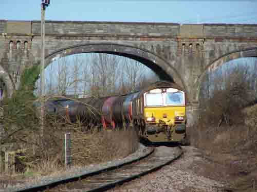
Fig 2 - Looking north
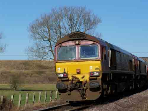
Fig 3 - Looking north
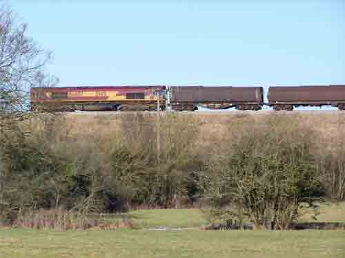
A 66 heads west on the main line
Fig 4 - The crossing location
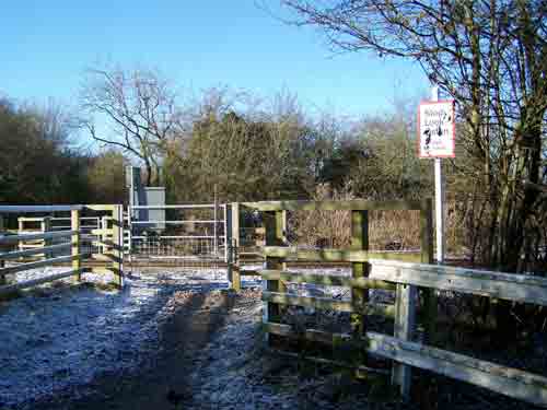
Fig 5 - Looking south
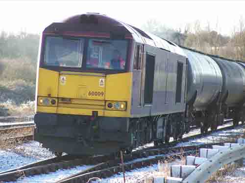
Fig 6 - Looking east
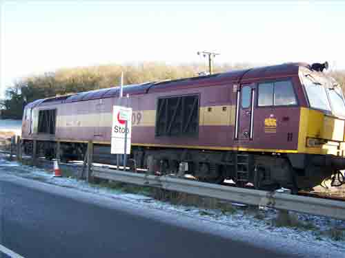
Fig 7 - Looking south
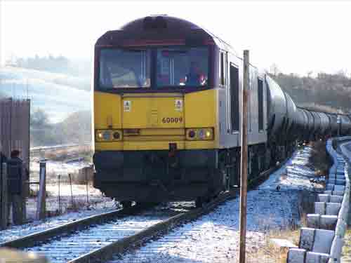
Disclaimer
All information contained within this is site is � Trainspots. The images used on this site remain the property of the original photographer, as credited at the top of the page, and are used with their kind permission.
The information on these pages is supplied for the benefit of railway enthusiasts who carry out a harmless hobby, and through the medium of photography and video, actually promote the railway industry. Railway enthusiasts can also act as eyes and ears against railway vandalism, and as such should surely be encouraged to do so by the supply of adequate information such as is found on this website.
This site has been created to assist railway photographers in their travels around the country. It is based on the personal knowledge and experience. No liability can be held against the web site or its contributions for incorrect information. Trainspots will endeavour to check all information and corrections will be accepted and posted accordingly.
Advice as to the locations general environment is given as a guide on each page. This information is a GUIDE only. ALWAYS be careful with your equipment, Trainspots can not be held responsible for your personal security. Avoid leaving your property on display for all to see, be aware of your surroundings at all times. There are, sadly, people who will not think twice about trying to steal your equipment.
Trainspots DOES NOT condone trespass and none of the information on this site should be taken as a right to trespass on either railway or private land. To the best of our knowledge all locations are publicly accessible areas, where they are not contact information will be given to the appropriate authority for permission to be obtained.
The content of this site is created and intended for all age ranges but the content of sites linked from this site are not subject to the same intentions. Trainspots will attempt to check links for validity but as time passes and the site grows this will not always be possible. Broken, or indeed updates to, links should be submitted to the editor for inclusion in the updates. All links external to the Trainspots site are opened in a new browser window. Trainspots has been running now for over 10 years and there are imitation sites and guides to railfotspots. But we are a free site and we continue on the path we started out on over a decade ago to provide a useful guide to UK Railway Photographic Locations.


