New Mobile Site
We have just launched a new mobile version of this site - m.trainspots. This page will use your smart device's GPS to loctate you and guide you to locations that are close to your present location.
Location notes
On the Midland Main Line, midway between Wellingborough and Bedford.
At this point there are two lines, the main lines are raised and have a harder gradient over Sharnbrook Summit, whilst the freight avoids the summing with a gentler line to the east.
At this point there are two lines, the main lines are raised and have a harder gradient over Sharnbrook Summit, whilst the freight avoids the summing with a gentler line to the east.
Railway type and traffic
There are 4 East Midlands Trains services an hour, mostly operated by 222s with the odd HST. Quite often services pass in this area, so there will often be two workings in the space of a minute.
From around 12:00hrs on a good day there can be a procession of north-bound empty freights, mainly aggregate trains, as well as a couple of cement trains. There is little if any south-bound afternoon freight traffic.
From around 12:00hrs on a good day there can be a procession of north-bound empty freights, mainly aggregate trains, as well as a couple of cement trains. There is little if any south-bound afternoon freight traffic.
Environment
A road bridge in surrounded by trees and fields.
The bridge has been declared as a week bridge and has been made into a single lane with the provision of extra barriers. This makes the location much safer to stand around for long periods as you don't need to worry about the cars behind you.
The bridge has been declared as a week bridge and has been made into a single lane with the provision of extra barriers. This makes the location much safer to stand around for long periods as you don't need to worry about the cars behind you.
Road directions
From the A6 between Rushden and Bedford turn west off the road and follow the signs to Souldrop and Sharnbrook.
For the foot crossing location:
Continue past the bridge location and take left fork and keep forking left till you get into Back Lane. This is a very narrow single track road, so be very careful. Park your car immediately after crossing bridge, considerately so you don't block access to the driveway of the nearby property. On the left hand side of back lane there is a stile into a field, this can be very muddy in wet weather. Skirt round the edge of this filed walking in a downhill direction and after about 100yards there is a break in the hedge with another stile. Climb across this stile and after about 15 yards the pathway leads you to the line side and a public footpath across the line.
Although this is a public footpath trains pass here at full line speed (in excess of 100 m.p.h.) so be very very vigilant.
Click here to set up your location for directions to this location
Sharnbrook, Souldrop map co-ordinates
Parking
There is a small lay by to the north of the location with space for one or two cars.
Public transport
Stagecoach service 125 operates two hourly from Bedford and serves the villages of both Sharnbrook and Souldrop and crosses one of the bridges.
In addition Stagecoach service 'Mercury M50' operates hourly to Sharnbrook along the A6 from Bedford and Kettering.
Click here to set up your location for directions to this location
In addition Stagecoach service 'Mercury M50' operates hourly to Sharnbrook along the A6 from Bedford and Kettering.
Click here to set up your location for directions to this location
Sun Compass
Sun Compass using Suncalc by brought to you by Vladimir Agafonkin:
It might be necessary to adjust the time to suit your visit, this link should open with the current day.
Sharnbrook, Souldrop
Streetmap links
Sharnbrook, Souldrop general view map
Sharnbrook, Souldrop close up map
Windows Local Live Link - image quality may vary
Sharnbrook, Souldrop
It might be necessary to adjust the time to suit your visit, this link should open with the current day.
Sharnbrook, Souldrop
Googly map
Sharnbrook, Souldrop general view map
Sharnbrook, Souldrop close up map
Windows Local Live Link - image quality may vary
Sharnbrook, Souldrop
Who likes this location on facebook
Railway Gen Group
Photographic notes
The bridge sides are about 7 feet high, so steps will be required to see over. The embankment offers a good unrestricted view of the side of train in either direction.
The early morning suits southbound shots, with the sun moving to the wrong side of the line after 11ish. Later on in the evening the sun will be better for northbound workings.
There is an occasional noise problem with loud engines at the nearby Santa Pod Race way that could interfere with sound recording. However, the height of the bridge parapet makes setting up of video tripods very difficult.
Links to photographs at this location
Phanyasrail Galleries - Souldrop
Rail-net GWRB tour 2004 - Sharnbrook
Phanyasrail Galleries - More Souldrop
General views - All photographs © Marcus Dawson unless otherwise stated
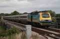
Fig 1 - Looking south
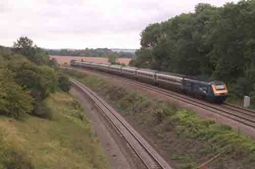
Fig 2 - Looking north
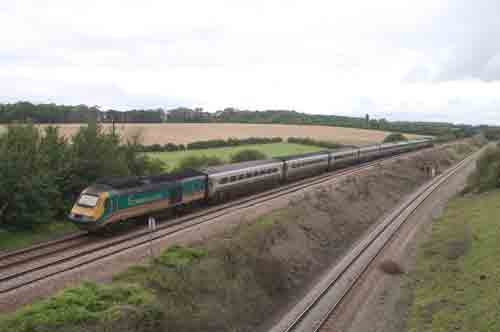
Fig 3 - Looking north
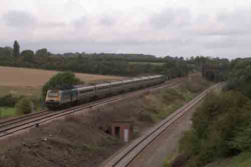
Fig 4 - Looking north
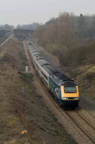
A southbound ECS working on the summit avoider.
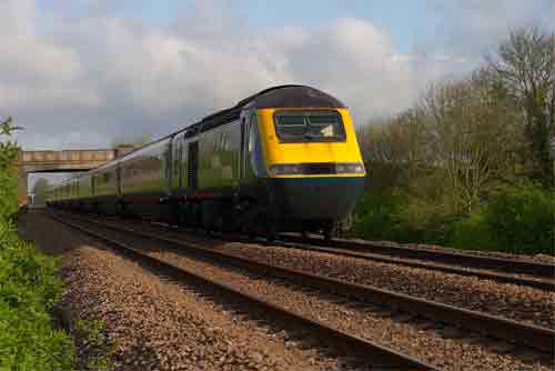
Fig 5 - Looking south
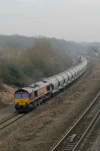
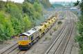
Northbound freight on the summit avoiding line.
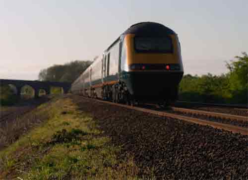
Fig 5 - Looking south - Photo by John Patston
From the foot crossing.
This foot crossing has been marked for closure in 2018.
Fig 7 - Looking north - Photo by John Patston
From the foot crossing.
This foot crossing has been marked for closure in 2018.
Disclaimer
All information contained within this is site is © Trainspots. The images used on this site remain the property of the original photographer, as credited at the top of the page, and are used with their kind permission.
The information on these pages is supplied for the benefit of railway enthusiasts who carry out a harmless hobby, and through the medium of photography and video, actually promote the railway industry. Railway enthusiasts can also act as eyes and ears against railway vandalism, and as such should surely be encouraged to do so by the supply of adequate information such as is found on this website.
This site has been created to assist railway photographers in their travels around the country. It is based on the personal knowledge and experience. No liability can be held against the web site or its contributions for incorrect information. Trainspots will endeavour to check all information and corrections will be accepted and posted accordingly.
Advice as to the locations general environment is given as a guide on each page. This information is a GUIDE only. ALWAYS be careful with your equipment, Trainspots can not be held responsible for your personal security. Avoid leaving your property on display for all to see, be aware of your surroundings at all times. There are, sadly, people who will not think twice about trying to steal your equipment.
Trainspots DOES NOT condone trespass and none of the information on this site should be taken as a right to trespass on either railway or private land. To the best of our knowledge all locations are publicly accessible areas, where they are not contact information will be given to the appropriate authority for permission to be obtained.
The content of this site is created and intended for all age ranges but the content of sites linked from this site are not subject to the same intentions. Trainspots will attempt to check links for validity but as time passes and the site grows this will not always be possible. Broken, or indeed updates to, links should be submitted to the editor for inclusion in the updates. All links external to the Trainspots site are opened in a new browser window. Trainspots has been running now for over 10 years and there are imitation sites and guides to railfotspots. But we are a free site and we continue on the path we started out on over a decade ago to provide a useful guide to UK Railway Photographic Locations.